
Slieve Alp [Sliabh Ailp]
Good walks are even better shared.
Overview
Slieve Alp [Sliabh Ailp]
Overview
Slieve Alp stands as a proud sentinel over the Derryveagh Mountains, reaching an elevation of 579 meters. Notably classified as a Hewitt, it attracts hikers eager to soak up its splendid views and rugged terrain.
Geology
The region showcases magnificent sandstone and conglomerate formations, sculpted by the persistent forces of nature. The remnants of glacial activity are evident, accentuating the area’s unique topography. If rocks could talk, these would tell tales of the ancient landscapes that once thrived here.
Routes
There are a couple of well-trodden paths leading to the summit:
- The Glenelly Valley Route: A delightful route through Glenelly Valley with a mix of winding grass and rocky sections, this walk is both refreshing and moderately challenging, taking about 3.5 hours to complete.
- The Knockmoyle Loop: For those with a thirst for adventure, this route offers an exhilarating circuit that encompasses both the beauty and challenge of Slieve Alp. Expect to spend around 4 hours navigating this beautiful trek.
Summit Features
Upon reaching the top, hikers are greeted by a sturdy stone cairn and a trig point where you can proudly declare your ascent to fellow adventurers. The sense of achievement is palpable here!
Terrain Type
Be ready for a varied landscape that combines rocky terrain, lush grassy slopes, and the occasional swampy surprise—true to its Irish heritage.
Views
From the summit, prepare to be awestruck by stunning panoramas of the Donegal countryside. The Sperrin Mountains loom in the distance, and if you’re lucky, the Atlantic glimmers can be spotted far off. Spring and autumn present the best chances to experience these majestic views, particularly when the flora is in bloom.
Hazards
While Slieve Alp is thrilling, keep your wits about you! Wet rocks can be slippery, and the weather can change on a dime. Always venture prepared—not just for the ascent but for any surprises that nature might throw your way!
Nearby Summits
Looking to extend your adventure? Check out nearby peaks like Culcaigh Mountain at 616 meters and Meenakill at 620 meters, both offering their own challenges and views.
Access
- Nearest Parking: The Glenelly Valley car park is your best bet and has reasonable capacity. Arrive early to avoid the scramble!
- Public Transport: Public transport options are somewhat scarce, so plan accordingly.
- Nearest Town: Strabane is the closest town, about 15 kilometers away, perfect for those post-hike refuel stops.
Facilities
While there are no amenities at the mountain's base, the nearby town of Strabane does have essential services like cafes and toilets to refresh you after an exhilarating day.
History
The name 'Sliabh Ailp' translates to 'Mountain of the Elm,' a nod to the majestic trees that once carpeted the area. Historically, this mountain has captured the imaginations of locals and has an important place in local folklore, highlighting its cultural significance.
So there you have it—a romp through Slieve Alp, where hills meet heritage and adventure awaits at every turn. Don’t forget your boots, a good walking stick, and perhaps a snack or two to keep you going on your climb into the clouds!
Explore routes near Slieve Alp [Sliabh Ailp]
Public walks starting within 80 km of this hill. Nearby does not mean a route reaches the summit; check its map and access before setting out.
No public routes are currently listed within 80 km of Slieve Alp [Sliabh Ailp] on Walkmates. This does not mean there are no paths here. Explore the map and check local access information before planning a walk.
Route planning notes
These notes describe possible approaches, not verified navigable routes or permission to cross land. Check current paths, local access rules and conditions before setting out.
The Glenelly Valley Route
A scenic approach through Glenelly Valley, leading up through grassy paths with occasional rocky sections.
The Knockmoyle Loop
A circuitous route that provides varied terrain and stunning views over the surrounding landscapes, ideal for those who enjoy a little exploration.
Make a day of it, together
Find someone to share the walk with, or organise a day out along a route you like.
Hill facts and local notes
Classifications
Elevation
329m
1,079 ft
Prominence
192m
Coordinates
54.0547, -9.7323
F866131
OS Map
23
At the Summit
The summit boasts a large stone cairn and a small trig point, both offering great photo opportunities for those claiming a summit victory.
Terrain & Geology
Slieve Alp is primarily composed of sandstone and conglomerate, giving rise to its craggy features and steep slopes. The rock formations are a testament to the region's geological history, shaped by glacial activity which has left behind pronounced features and deep valleys.
Views & Scenery
From the summit, you can view the sprawling Donegal countryside, as well as the beautiful Sperrin Mountains and even the distant Atlantic Ocean on a clear day.
History & Heritage
Name Origin
The name 'Sliabh Ailp' translates to 'Mountain of the Elm', which refers to the natural landscape once dominated by elm trees.
Historical Significance
The mountain is locally significant, featuring in folklore and offering a variety of ecosystems that support local wildlife.
Getting There & Facilities
Check current local access restrictions, parking rules and transport timetables before travelling. These notes do not confirm public access to the summit.
Parking
Parking is available at the Glenelly Valley car park, which can accommodate several vehicles. Arrive early during weekends to secure a spot.
Public Transport
Limited public transport is available to the area, so it may be necessary to use a car or arrange for a ride.
Nearby Facilities
There are no facilities directly at the mountain but Strabane offers cafes, shops, and public toilets.
Safety Information
Known Hazards
- Be cautious of slippery rocks, particularly after rain. The changing weather can reduce visibility quickly, so it’s wise to be prepared.
General Safety Tips
- Check weather conditions before setting out
- Carry appropriate clothing and equipment
- Let someone know your planned route
- Take a map, compass, and GPS device
- Carry emergency supplies: food, water, first aid kit, torch
Hills
Some common questions about the hills answered
Are there group walks up Slieve Alp [Sliabh Ailp]?
Many walkers use Walkmates to join or organise walks with others. You can check for group walks around Slieve Alp [Sliabh Ailp] through the maps
Are there other walkers around Slieve Alp [Sliabh Ailp]?
Activity varies by location and time, but Walkmates lets you see whether others have shared walks or shown interest in this area. Find other people through the walking friends search walking friends for Slieve Alp [Sliabh Ailp] search or of course create your own walk for Slieve Alp [Sliabh Ailp]
Can I organise a walk to Slieve Alp [Sliabh Ailp]?
Yes. If there aren’t any walks listed already, you can create a walk and make it available for others to join.
If you're signed up to Walkmates, you can create a walk to Slieve Alp [Sliabh Ailp].
How do I find a walk up this hill?
There are often multiple ways to walk this hill, depending on experience and route preference. Walkmates helps you explore walks and routes that others have shared.
Can I suggest a new route up Slieve Alp [Sliabh Ailp]?
Yes. You can suggest or create routes to share with others. Walkmates focuses on the social side of walking, so routes are used to help people organise walks and explore areas together, rather than as detailed navigation tools or route libraries.
Other uses really appreciate knowledgeable walkers sharing their routes. Share your favourite route to Slieve Alp [Sliabh Ailp] here
The is an error or something incorrect about this hill. How do I let you know?
We always strive to keep the information on Walkmates as accurate as possible. If you find an error, please let us know through the contact form and we'll aim to correct it as quickly as possible
Community Discussion
Comments
Location
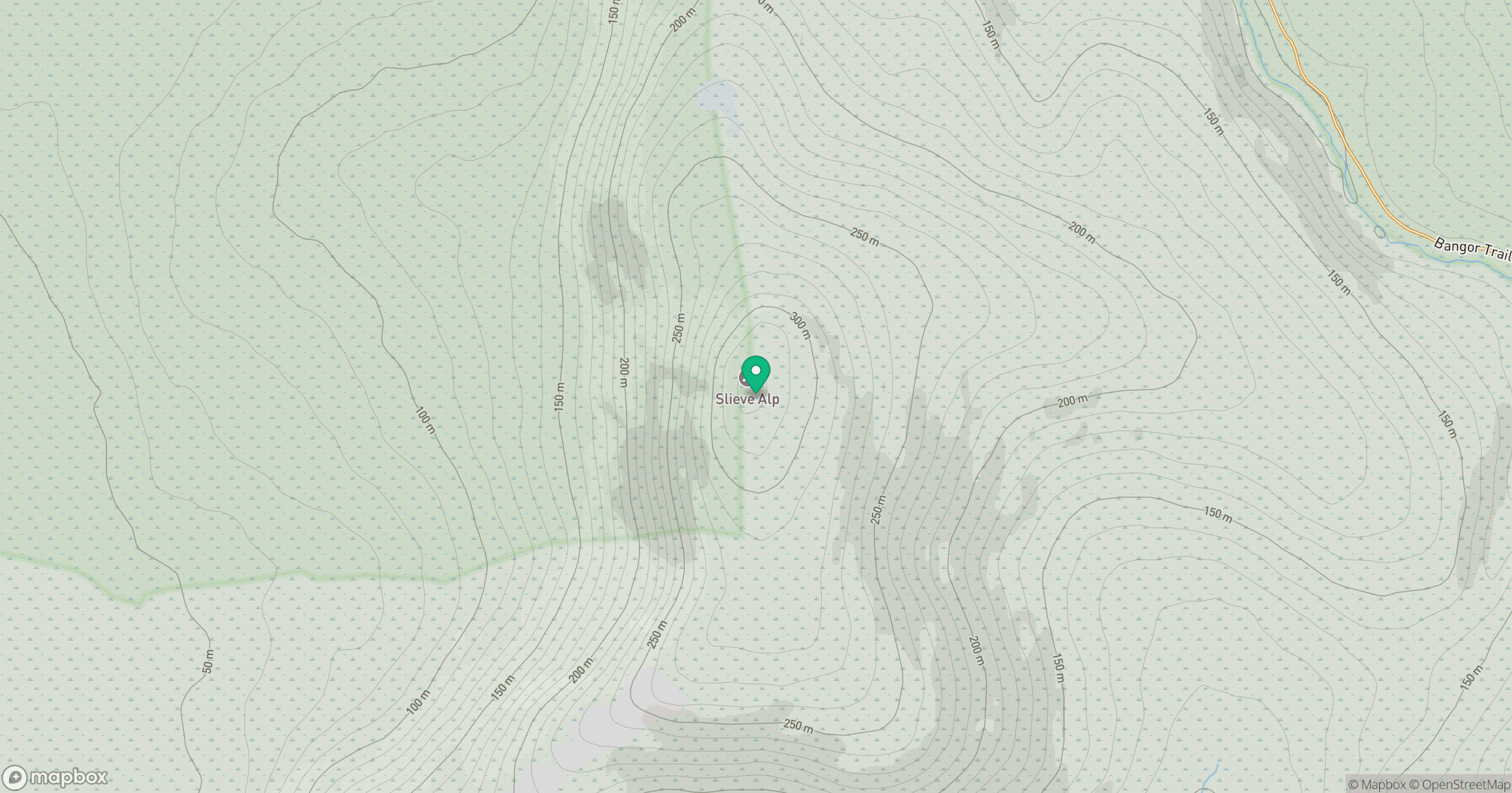
Grid reference: F866131
View on OpenStreetMapOpens a map in a new tab, centred on the hill.
Hills within 30 km
Straight-line distance, not a walking route or confirmation of access.
No comments yet. Be the first.